


Google Earth, Columbia University Map Seafloor Area Bigger Than North America
June 09, 2011 at 07:10 AM EDT

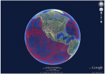
Thursday marked World Oceans Day , a United Nations effort to "raise global awareness of the challenges faced by the international community in connection with the oceans." Getting in the spirit, Google Earth and about a dozen research labs paired their data, talents and technology to create highres maps of seafloor terrain. Columbia University's Lamont-Doherty Earth Observatory led the charge contributing its Global Multi-Resolution Topography (GMRT) Synthesis and some 20 years worth of data from 500 ship cruises. The interactive topo maps they created portray an underwater area bigger than North America. Such visualizations help scientists understand natural and man-made disasters including: tsunami events and runups, earthquakes...
